| |
Why a Hikes & Adventures Page?
I created the page to show those in Turlock that there is beauty within and beyond the Great Central Valley. Sixty miles east or west from our flat home in the Great Central Valley lie vistas and scenery that rival any in the world. The grandeur-induced euphoria of being in the Sierras’ inspired my fascination with the Earth at an early age and continue to do so today. I try extremely hard to make that fascination as contagious as possible in my geoscience classes by sharing my passion and experiences through photos.
I want you, my students, and your families to experience the awe-inspiring joy of the outdoors by getting out of town and visiting your amazing backyard.
It's not as hard as it seems, and the rewards and photos are timeless.
The majority of the hikes on this page are within 100 miles of Turlock , which make them great candidates for dayhikes during the summer season. The hikes feature detailed Topo maps, a virtual GOOGLE EARTH fly-by and the fishing opportunities presented along the trail. The hikes after 2007 also have photo captions describing each photo, which could be very helpful on a test someday.
Please have fun, be safe and please practice catch & release when fishing in the wilderness. -Mr H- |
How to Use the Interactive Hikes & Adventures Page
- Clicking on a geographic link above will open a page with an interactive map dedicated to the photographic telling of my hikes & aventures.
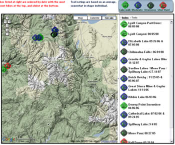
- Once the map is open you have two ways of checking out a hike
- The first way is by clicking on the hike's placemark on the map,
or by clicking on the hike's title in the column at right

- An information balloon will then pop-up (see below) with all of the information about the hike and links to the Virtual hike Google Earth, topo maps and hiking photos.

- Here's what the photo albums generally look like

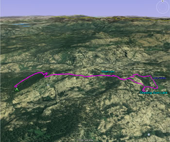
- Lastly, here's an idea of what a hike in Google Earth looks like
|
Useful Programs I Use all of the time. |









