Geology of the High Sierra 2013

Three-day geology field class headquartered at Baker Station near Kennedy Meadows led by the awesome MJC Professor Noah Hughes. We journeyed up HWY 108 to piece together clues that told the story of the Little Walker Caldera that was active from about 20 Ma to 5Ma. We also formed a better understanding of the entire foothill-Sierra geomorphology of the past 200 million years. The trip got participants well-acquainted with the six "chapters" of creation in the area and even had a successful fossil hunt near Don Pedro Reservoir. Super Trip!
Noah started the class at a road cut near Don Pedro Reservoir and drew several cartoons to help students visualize the formation of the now metamorphic Mariposa Formation.  Long story short, sedimentary deposits washed-down from the Klammath mtns, Sierra Volcanic Arc and Western Nevada coastline about 151 million yearas ago into a large forearc basin. Graded sedimentary beds in the formation are good evidence that large underwater debris flows called turbidites occured frequently. The various sediments were then wedged into subducting trenches and metamorphosed into the layers we see today. Noah shows a great example of the Mariposa Fmt and points out graded bedding. Notice the coarser-grained sediments on the left and finer-grained sediments on the right.  Tell-tale graded beds.  Lens cap is 72mm for scale. I've played with the contrast here to better highlight the rip-up clasts - old mud or rock flakes ripped-up by turbidity currents and incorporated into the mix.
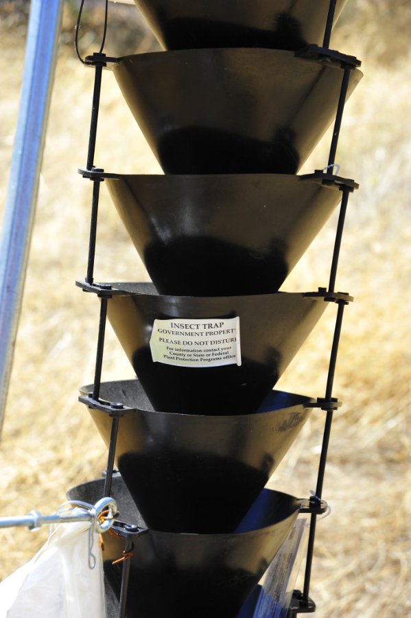
If one looks hard enough they can find pyritized buchia fossil molds. Students lend some scale to the slates. Government Insect Study contraption. Curious. To get to the fossil honey-hole we had to scramble down a mildly-steep embankment. Abner shows us how it's done.
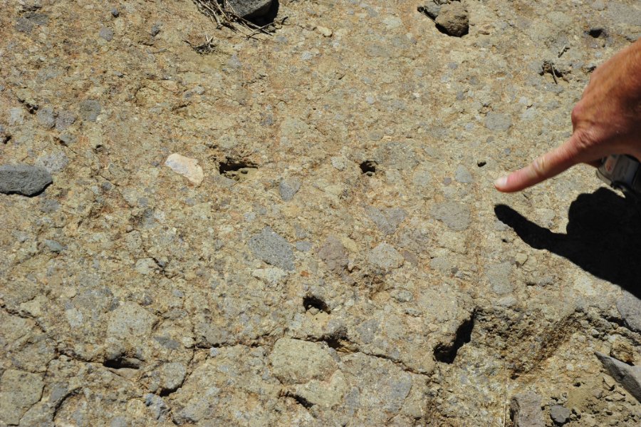
Fossil display trays carried dutifully down hill by Art. An interesting and somewhat perplexing conglomorate made of small pebbles. Buchia success! Buchia bonanza!
A rare find in these turbidites - buchia fossil with the "hinge" in tact.  This suggests a rather calm deposition or very lucky survival in a turbidity current. A great little overview of the outcrop. Noah offered some incentives to find a complete ammonite fossil.  Dan found a most improbable complete ammonite!  It was a whopping 1cm!  And it preserved structure!  What a find. Thumb for scale next to ammonite fossil. I need a manicure.
Next stop was up HWY 108 near Cold Springs.  We were here to investigate the cover sequence of the Eureka Valley Tuff that is about 9-10Ma.  Note the air-fall rhyolite tuff and pumice in the foreground.  Dodge Ridge ski runs are in the distance, along with Pinecrest Peak (center) and the Three Chimneys (center far distance). The class takes a look at the tuff. A shoe tree is blooming! Laura and Zephyr made it!
Zephyr and mom enjoy checking out the brecciated lahar flows.  The clasts (broken chunks of rock in the flow) are nearly impossible to yank out by hand.  Feels like concrete! Zephyr makes his first geologic field observations. Our next stop was Donnell Vista ovelooking Donnell Reservoir.  This picture infuriates me due to the fact that several idiots rode their dumbass midget bikes down the paved HIKING trail.  Lazy old bastards.  Their liscence plates are en route to the NFS. Donnell Reservoir was surprsingly full considering the piss-poor water year that was had on the Stanislaus drainage.
Gotta stay hydrated!  A room with a view at Baker Station. I'd say that's a happy mom and Zephyr! Zephyr had learned so much by 8pm that he had to call it a night. We started the second day at Blue Canyon near Deadman Creek on HWY 108.  The goal was to map and parse out the geologic history of the area.  Laura looks back up from the "trail head" that leads across Deadman Creek to the Blue Canyon Lake trail.
Lupine was going bonkers! Columbine Scarlet gilia (aka scarlet trumpets).  The fly says to buzz-off. This photo explains why we visited this particular location:  a great contact the between overlying lava flows (dark blue,grey) on the left and underlying granitic basement rocks on the right (light grey and yellowish).
A clue!  Petrified wood remnants in a lava flow.  (Camera lens to scale) Mariposa lilies dot the broken volcanic flows. More scarlet gilia. Laura and students look over the brecciated lava-flow.
Great views after a brief steep hike.  This section of the formation was interesting due to the fact that there were large, rounded grantic boulders and other rounded cobbles stuck in the flow matrix.  Some of the flow almost looks like a lahar with cemented sands, while other parts of the same flow look like lava flows with a porphyritic affinity.  RJH8470 A close-up of the granitic boulder that is included in the flow. One thing is for certain.  This lava flow/lahar breccia flowed down a wet, forested canyon as preserved by the petrified wood and rounded cobbles included with the angular clasts. Lens cap is 72mm (3inch) for scale.  The paper-wasp nest was pretty cool too.
Very well preserved petrified wood with silica-rich veins. The more I looked, the more wood we found. A great view up Blue Canyon.  The u-shaped canyon is a result of glacial scouring. Blue Canyon Creek.  The steep hanging valley in the middle of the photo is a result of the Blue Canyon Fault.  The foreground (headwall) has dropped about 80 meters relative to the background (footwall).
 RJH8485 A tremendous view down the glacially carved canyon down to Chipmunk Flat.  Note the two students on lower left lava flow and car on HWY 108 for scale. Intrepid explorers - Sheri, Erika and Laura. Granitic cobble included in the breccia.  The granite canyons had been exposed at the time of the lava flows.  Most chunks in the breccia in this area are sub-rounded, implying that rivers or streams had previously worked in the area prior to the eruptions.
Volcanic sediments make great nutrients for plants, even at 9,000ft!  RJH8507 Glacially-polished section of the lava-flow breccia. Trail leading up Blue Canyon.
Lupine! Deadman Creek crossing. Note the granite! Zephyr was done being carried on Dad's back. A grand view from the Leavitt Falls overlook that peers into the heart of the Little Walker Caldera - one of the areas that fed the lava flows which erupted over the landscape starting about 30 million years ago and ending about 5 million years ago.
View of Leavitt Meadows with the West Walker River meandering lazily for this time of year. Leavitt Falls, great example of a hanging valley created by the intersection of the tiny Leavitt Creek glacier and much larger West Walker glacier during the past ice age. View towards Kirman Lake. Zephyr liked it?
A few sunset views just above Kennedy Meadows. A few sunset views just above Kennedy Meadows. A few sunset views just above Kennedy Meadows. First stop of Day 3 - The Crack!  An awesome site for several reasons.  1 - three sets of joints in the granite are followed and eroded by the Stanislaus River here to make a small gorge.  2 - Lava erupted from this area a mere 150,000 years ago! You'll see its source soon.
Yup, that's not a place you'd want to fall. The pool at the end of the crack harbors large trout. But it's hard to fish without a rope. Noah stands next to the basaltic feeder-dike of the 150,000 year old Column of the Giants lava flow.  Was the basalt (dark grey) offset by a left-lateral fault?  If it was it could represent the earliest signs of the Sierra Nevada Microplate ripping-off of the North American Plate. Time will tell. Noah points out the feeder dike.
So what did the feeder-dike feed?  This large lava flow pooled and cooled slowly behind a large moraine 150Ka.  The slow, directional cooling caused the columns to contract and make joints in hexagonal (or pent/sept) arrangements.  Thus the now famous Columns of the Giants. Two flows are visible in cliff. A chunk of column talus.  Lens cap is 78mm (3in) for scale. Noah offers a good sense of scale in the talus. Talus anyone?  Cool air flows out of the talus from the previous year's snow melt and ice insulated from the sun by the broken columns.  Wouldn't it be nice to have a fountain made of this stuff?
Last stop of the day and trip was to Natural Bridges Recreation Area near New Melones Reservoir.  Why travel down this dusty, hot, poison oak-filled path?  You'll see. The surrounding hills are all composed of Calaveras Formation marble, part of the Western Sierra Nevada Metamorphic Belt.  The marbles started life as marine sediments and were jammed and scraped-off onto North America during the Paleozoic and Triassic.  Coyote Creek Canyon is in front of us.  Note the red clay bits that eroded out of the marble and now cover the trail. This hole in the ground provides a clue as to how the Natural Bridges youa re about to see formed.  This is a spring... Just down slope from the spring are these neat formations.  It turns out that groundwater dissolves calcium carbontate in marble bedrock.  An old spring at this location allowed the calcium carbonate-rich water to precipitate out and create travertine.  One spring on each side of Coyote Creek eventually caused the travertine terraces to meet in the middle and create the Natural Bridge.
Noah gets the class prepped to see the caverns from the best perspective: swimming underneath them! Noah points out the active spring (local water table height) flowing into the underside of the cave... all the while precipitating out new, microscopic layers of travertine. I wish I'd had scale in the photo.  The "hole" is about 8ft tall. Cave drapes.
Sping showers bring July hikers down to cool off. I neglected to bring my tripod. But this blurry shot gives a nice sense of scale.  RJH8650 Water reflections on the few ferns that eek out a living on the walls.
Maiden-hair fern, I believe. Purposely underexposed to capture the dancing reflections of the creek.  RJH8666 Our minds full of geology and fun, we headed back up the hill.
One last shout-out to Erika, a nursing student on our trip that helped-out a tourist that suffered heat-stroke on the trail.  She helped the victim until paramedics could arrive... LOTS of paramedics. And that is how we ended the trip!